Artec Jet LiDAR Scanner

Mobile LiDAR scanning for fast, large-scale reality capture

Looking for a mobile LiDAR Scanner in the UK?

Artec Jet is a high-speed mobile LiDAR scanner designed for fast, accurate capture of large environments.

Using SLAM-based positioning and AI-driven autonomy, Artec Jet captures survey-grade data across indoor, outdoor and GPS-denied environments. With a LiDAR sensing range of 0.5–300 metres and acquisition speeds of up to 1,920,000 points per second, it enables teams to map extensive spaces efficiently while moving through the site.

As part of the wider Artec 3D scanner range, Jet extends 3D capture to large sites and environments, complementing close-range and terrestrial scanning systems within a broader reality capture workflow.

Use it handheld or mount it to a backpack, vehicle, robot, drone, pole or cage. This flexibility makes Artec Jet suitable for applications ranging from construction and infrastructure to underground mining, defence and public safety.

Why choose the Artec Jet?

Artec Jet is built for organisations that need to capture large or complex environments without relying on conventional static scanning workflows.
Its combination of SLAM-based positioning, seven deployment modes and GPS-free operation allows teams to adapt the scanning process to the site. The system can be carried through buildings, mounted to a vehicle for larger areas or deployed remotely where access is difficult or hazardous.
At 1.57 kg, Artec Jet combines a lightweight design with a 360° × 290° field of view, long-range LiDAR capture and field-ready protection for demanding reality capture applications.

Artec Jet SLAM LiDAR 3D scanner

Capture large environments while moving

Artec Jet uses SLAM-based LiDAR to map continuously as the scanner moves through its surroundings.

This reduces reliance on repeated fixed scan positions and supports efficient capture across buildings, tunnels, industrial sites, infrastructure and other large environments.

The scanner captures up to 640,000 points per second in single-return mode and up to 1,920,000 points per second in triple-return mode, with a sensing range extending from 0.5 to 300 metres.

Artec Jet mounted on Robot

Work without GPS

GPS-free positioning allows Artec Jet to operate indoors, underground and across other environments where satellite positioning is unavailable.

This makes it particularly relevant for tunnels, mines, enclosed industrial spaces and complex sites where maintaining reliable positioning can otherwise be difficult.

Artec Jet also supports zero-light operation, carries an IP65 rating and has an operating temperature range of -10°C to 45°C, allowing it to work across varied field conditions.

SLAM LiDAR mapping in GPS denied environment with Artec Jet

Choose from even deployment modes

Artec Jet can be deployed handheld or mounted to a backpack, drone, vehicle, ground robot, pole or cage.

This allows the same system to be adapted to different sections of a project rather than requiring one fixed scanning method throughout.

Remote deployment can also help reduce the need for personnel to enter hazardous, inaccessible or difficult-to-reach areas directly.

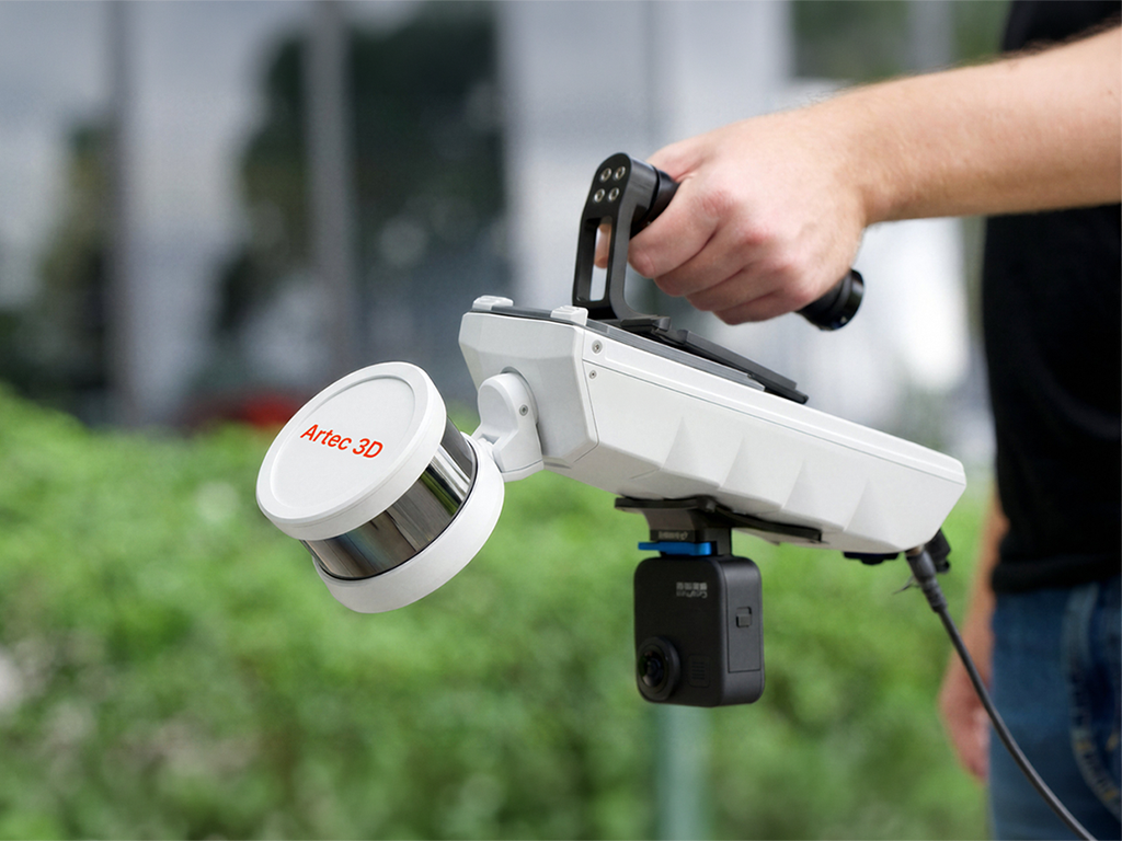
Artec Jet handheld LiDAR 3D scanner

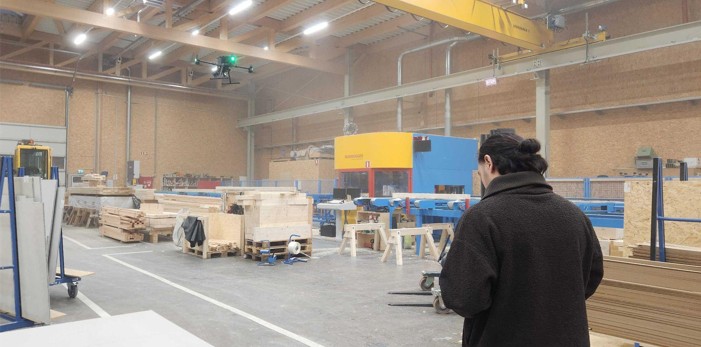
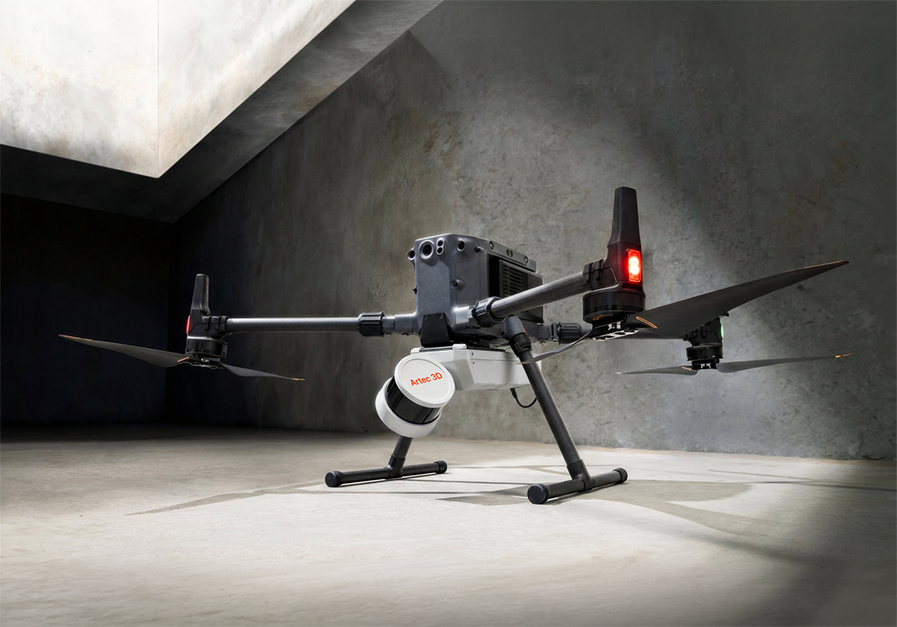
Autonomous drone mapping with Artec Jet

Artec Jet supports autonomous drone operation for environments where manual access may be difficult or unsafe.

Its AI-powered autonomy system uses waypoint navigation, path planning and proximity sensing to move through GPS-denied spaces while maintaining scene capture.

Omnidirectional LiDAR provides 360° collision-avoidance coverage and can detect obstacles as small as 2 mm wire. Return-to-home functionality can also guide the platform back along a mapped route in situations such as low battery.

Real-time point cloud capture

Artec Jet provides real-time point cloud streaming to a companion application, giving operators visibility of captured data while still on site.

An on-site scan preview can be used to check coverage before capture is complete, helping teams identify missing areas while they are still in a position to rescan them.

The system includes 512 GB of onboard storage for up to four hours of scanning. Supported point cloud formats include LAS, LAZ, PLY and E57, with optional RGB capture available where colour information is required alongside LiDAR data.

Artec Jet SLAM LiDAR 3D scanner
Technical Data Artec Jet

Mapping method

SLAM-based LiDAR, ±0.03% drift
LiDAR sensing range 0.5-300 m
LiDAR accuracy ±10 mm
Mapping accuracy, general / indoor ±10 mm / ±15 mm
Field of view 360° x 290°
Weight 1.57 kg
Onboard storage 512 GB, up to 4 hours

Speak to Mark3D about the Artec Jet

If you are assessing mobile LiDAR scanners or looking for a more flexible approach to large-scale reality capture, Mark3D can help determine whether Artec Jet is suitable for your application.

Our team can advise on your site conditions, deployment requirements and intended outputs, as well as how Artec Jet could work alongside other Artec scanners within a wider scanning workflow.

Contact Mark3D to book a scanning demonstration, request pricing or discuss your requirements.

Mark3D UK Limited
Romsley Point
Farley Lane, Romsley, Halesowen, B62 0LG

Phone: +44 121 661 1151
Freephone: 0800 193 3650
Email: printstronger@mark3d.co.uk


Logos of companies using Markforged 3D printers

Request a Tailored Quote

Tell us about your application, workflow requirements, or project objectives and our team will prepare a tailored recommendation based on your operational needs. We can also arrange demonstrations, sample evaluations, and technical discussions where required.

This field is for validation purposes and should be left unchanged.
Name(Required)
Email(Required)
Address(Required)
Please select the product/s you're interested in ..(Required)
This field is hidden when viewing the form

Part of a complete 3D scanning workflow

Artec Jet integrates with other systems in the Artec ecosystem, including Artec Ray II for long-range, high-accuracy laser scanning, and Artec Leo for handheld, high-resolution 3D scanning.

Together, these technologies support a complete reality capture workflow, from large-scale site mapping through to detailed component-level scanning.
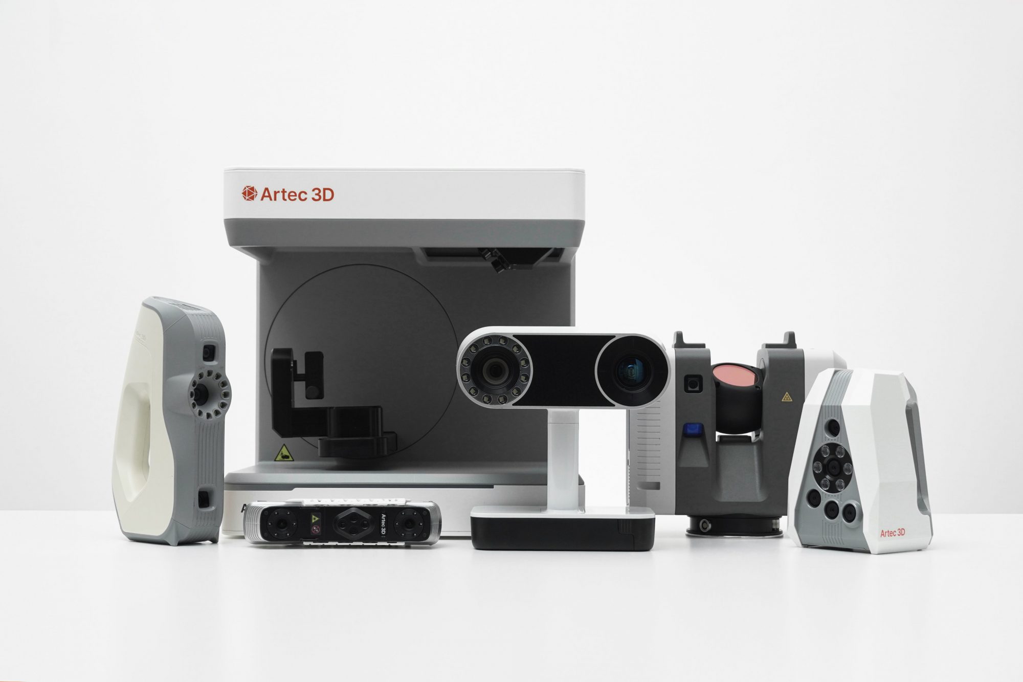
Complete your digital workflows with Artec's 3d scanners

Frequently asked questions about the Artec Jet

What is the Artec Jet?

Artec Jet is a mobile SLAM-based LiDAR system designed for fast capture of large environments.

It can operate indoors, outdoors and in GPS-denied locations, with seven deployment modes including handheld, backpack, vehicle, robot and drone scanning.

What is the scanning range of Artec Jet?

Artec Jet has a LiDAR sensing range of 0.5–300 metres.

It can capture up to 1,920,000 points per second in triple-return mode, supporting rapid data collection across large environments.

Does Artec Jet need GPS?

No. Artec Jet uses SLAM-based positioning and can operate without GPS.

This makes it suitable for indoor, underground and enclosed spaces such as buildings, tunnels and mines.

Can Artec Jet be mounted on a drone?

Yes. Drone or UAV deployment is one of the seven supported Artec Jet configurations.

The system also supports autonomous waypoint navigation, path planning, collision avoidance and return-to-home functionality with compatible drone platforms.

What industries is Artec Jet suitable for?

Artec Jet is suitable for sectors including construction and AEC, mining, civil infrastructure, oil and gas, defence, public safety, heritage preservation and forestry.

Applications include digital twins, as-built documentation, inspection, volumetric measurement, condition assessment and site mapping.

How does Artec Jet work with other Artec scanners?

Artec Jet is designed for large-scale mobile mapping and can be used alongside other Artec 3D scanner systems where a project requires data at different scales.

Artec Ray II supports long-range terrestrial laser scanning, while Artec Leo provides detailed handheld capture for individual objects and components. Artec Twins can then bring data from these different scanning methods together within a unified workflow.