
Artec Twins
Advanced 3D software for large-scale digital twins
Transform massive 3D datasets into accurate,interactive digital environments.
Artec Twins is powerful 3D processing, visualisation and analysis software designed to make working with large-scale 3D data faster, easier and more accessible.
From individual buildings and industrial facilities to infrastructure networks and entire landscapes, Artec Twins combines data from multiple sources into accurate, measurable digital twins that can be explored, analysed and shared.
Supporting data captured by 3D scanners, drones, smartphones and satellites, the software enables users to bring together different levels of detail within a single environment. Billions of data points can be rendered in real time, allowing even the largest datasets to remain fully interactive.
With advanced measurement and inspection tools alongside photorealistic visualisation, Artec Twins provides a complete platform for understanding, documenting and analysing the physical world.
Key Benefits of Artec Twins?
Process massive datasets without compromise
Artec Twins is engineered to handle exceptionally large 3D datasets, rendering billions of points at speeds of up to 200 frames per second.
Explore complex environments spanning 100 km² or more without reducing the underlying data, allowing users to retain valuable detail while navigating even the largest projects.
Combine data from multiple sources
Create comprehensive digital twins by combining data captured using different scanning and imaging technologies.
Integrate long-range LiDAR scans, detailed handheld 3D scanning, aerial imagery and other compatible datasets into one unified model, retaining high levels of detail wherever they are needed.
Accurate measurement and analysis
Move beyond visualisation with integrated tools for measuring, inspecting and analysing captured geometry.
Compare as-built conditions against CAD designs, calculate volumes, examine cross-sections and identify dimensional deviations to support engineering, surveying and inspection workflows.
Photorealistic digital environments
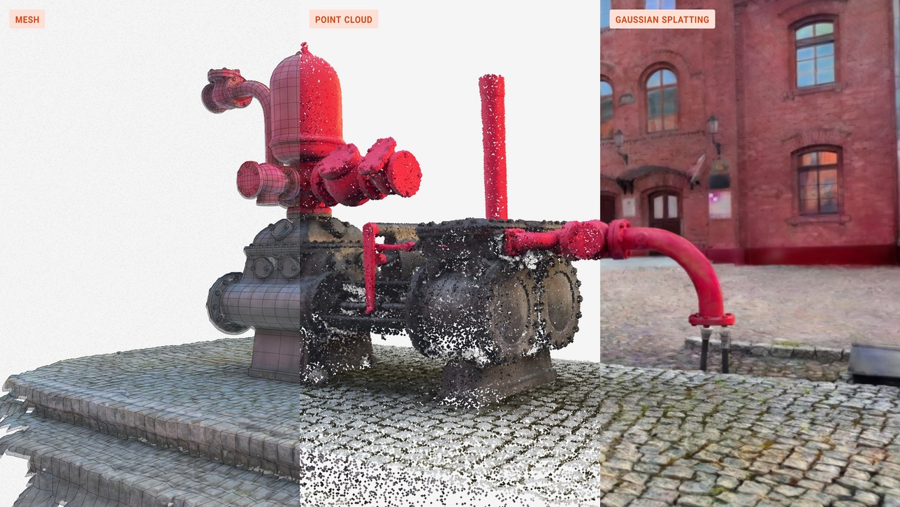
Create highly realistic 3D environments using integrated Gaussian Splatting technology.
Combining accurate geometry with photorealistic visualisation allows users to create compelling digital representations for remote inspection, project planning, stakeholder presentations and virtual walkthroughs.
Keep control of your data
Artec Twins processes data locally on your computer, eliminating the need to upload large or sensitive datasets to cloud-based services.
This provides greater control over project information and supports organisations working with confidential or commercially sensitive environments.
From 3D Scanning to Digital Twin
One platform. Multiple data sources. Complete environments.
Large-scale 3D projects often require different capture technologies to record everything from the overall environment to the smallest important details.
Artec Twins brings these datasets together, enabling users to create comprehensive digital representations of physical spaces and structures.
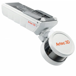
For example, an industrial facility could be captured using an Artec Jet LiDAR scanner to document the wider environment, with an Artec Ray II providing additional detail of important structures and an Artec Leo capturing individual components or complex features.
The resulting datasets can be aligned and combined into one digital twin, providing an accurate record that can be explored, measured and analysed.
This approach supports more effective documentation, planning, inspection and maintenance, while reducing the need for repeated site visits.
Advanced Visualisation and Analysis
Turn captured data into practical engineering information
Artec Twins combines powerful visualisation capabilities with integrated measurement and analysis tools.
Users can work with point clouds, 3D meshes and Gaussian Splats within the same environment, switching between accurate geometric data and realistic visual representations according to the task.
Key capabilities include:
Multi-source data fusion
Combine datasets from different scanning and imaging technologies into a unified digital environment.
Real-time point cloud visualisation
Navigate massive datasets containing billions of points without reducing the underlying geometry.
Gaussian Splatting
Generate highly realistic 3D scenes from compatible scan data, photographs or video.
Dimensional measurement
Measure distances, calculate volumes and extract cross-sections directly from captured data.
Inspection and deviation analysis
Compare scanned geometry against CAD references to identify differences between designed and actual conditions.
Georeferencing
Position datasets within real-world coordinate systems to support surveying and infrastructure applications.
Virtual walkthroughs
Explore captured environments using first-person navigation, supporting remote inspection, documentation and collaboration.
Applications for Artec Twins
Supporting engineering, inspection and digital documentation at scale
Artec Twins is particularly suited to applications where large environments need to be accurately captured, documented and analysed.
Industrial Facilities and Manufacturing
Create digital records of factories, production facilities and industrial installations to support layout planning, equipment installation, maintenance and facility modifications.
Architecture, Engineering and Construction
Capture existing buildings and construction sites, compare as-built conditions with design information and support planning, verification and project documentation.
Infrastructure and Asset Management
Digitise bridges, transport infrastructure, utilities and other large assets to support condition assessment, maintenance planning and long-term documentation.
Surveying and Mapping
Combine terrestrial and aerial scanning data to create comprehensive, georeferenced digital environments for measurement, analysis and mapping.
Heritage and Conservation
Create accurate digital records of historic buildings, monuments and large heritage sites, preserving both geometric information and visual detail for future reference.
Designed to Work with Artec 3D Scanners
Artec Twins supports the Artec 3D scanner range, allowing data captured using different technologies to be brought together within a single project.
It is particularly well suited to large-scale scanning workflows involving the Artec Jet and Artec Ray II, while also supporting detailed data captured using handheld scanners such as Artec Leo.
This flexibility enables users to select the most appropriate scanning technology for each application, without being restricted to a single capture method.
Artec Twins also supports common industry-standard file formats, allowing compatible data from other scanning and imaging systems to be incorporated into existing workflows.
Artec Twins – Technical Highlights
| Feature | Capability |
|---|---|
| Software application | Large-scale 3D processing, visualisation and analysis |
| Dataset handling | Billions of data points |
| Rendering performance | Up to 200 FPS |
| Environment size | 100 km² or more |
| Data integration | Multi-source 3D data fusion |
| Supported data types | Point clouds, meshes and Gaussian Splats |
| Analysis tools | Measurements, volume calculations, cross-sections and deviation analysis |
| Georeferencing | Supported |
| Data processing | Local processing |
| Operating system | Windows 11 (64-bit) |
| Licensing | Annual subscription or lifetime licence |
Performance depends on the dataset and computer specification.
Discover What Artec Twins Could Do for Your Business
Whether you’re looking to document an industrial facility, create accurate digital twins of infrastructure or improve the way you process and analyse large-scale 3D data, Mark3D can help you explore the possibilities.
Our team can advise on Artec Twins software, compatible 3D scanning technologies and the most appropriate solution for your application.
Contact Mark3D to discuss your requirements and discover how Artec Twins could support your workflow.
